Overview
A weak storm system remains on track to move across the region during the next 36 hours. This will bring unsettled weather and a brief change in the weather pattern for Central and Northern California today through Thursday night. The system will also bring the first chance of widespread rainfall to the region in more than a month.
*This will not bring a significant amount of rain to the area and will not have much of an impact on our ongoing drought status.
CONFIDENCE
· Moderate: Timing & Location
· Low to Moderate: Rainfall Amounts
UPDATED INFORMATION
· Update to forecast rainfall totals and timing of storm system.
TIMING
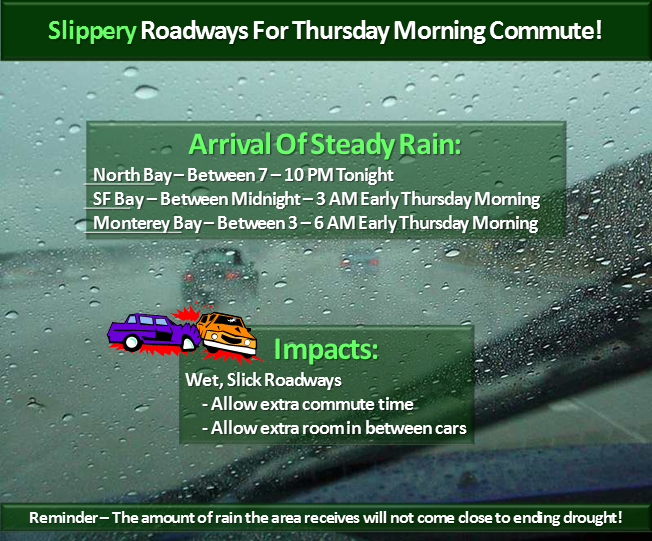
· Steady rain is expected to begin across the North Bay late this evening, then across the San Francisco Bay Area after midnight tonight. Rain chances spread southward across the Central Coast and Monterey Bay Area early Thursday morning.
· Another around of lighter precipitation is expected to move across the region from north to south on Thursday afternoon/evening.
· Greatest commute impact will be during the Thursday morning rush hour.
LOCATIONS
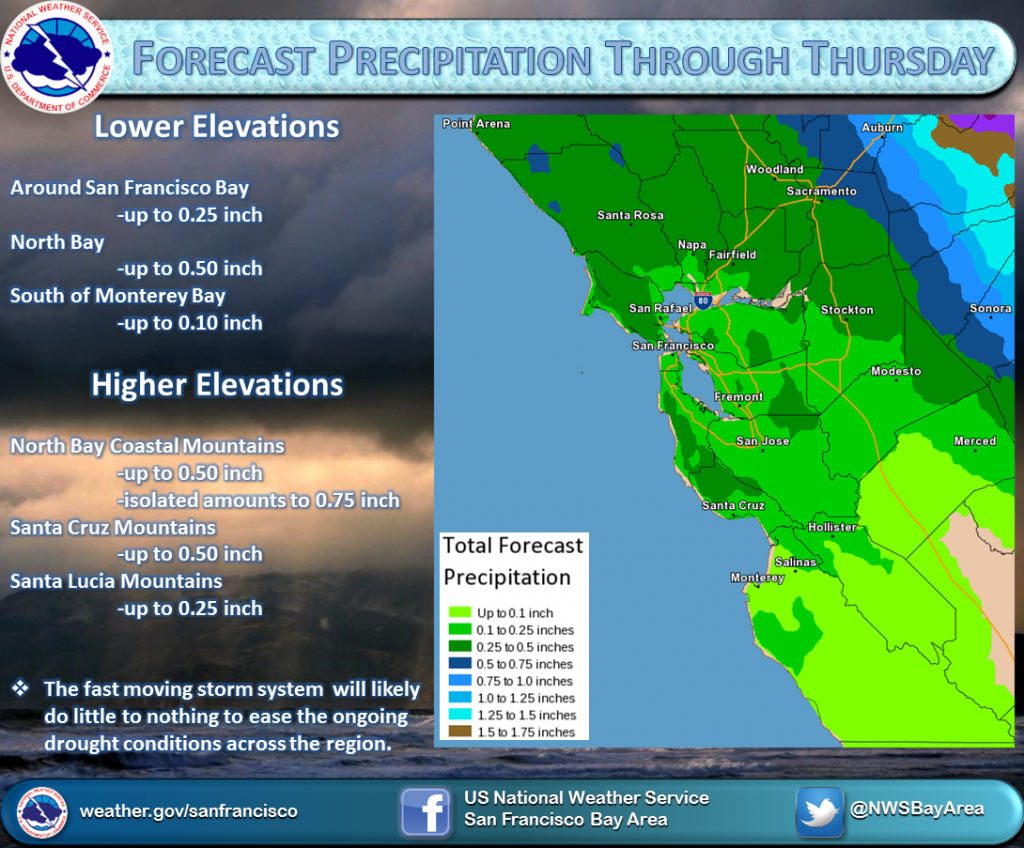
· North of the San Francisco Bay: Up to 0.50 inch except up to 0.75 inch in higher elevations and the coastal mountains.
· San Francisco Bay Area and locations to the South: Up to 0.25 inch except up to 0.50 inch in the Santa Cruz Mountains.
· Far southern areas (south of Monterey Bay): 0.10 inch or less except up to 0.25 inch in the Santa Lucia Mountains.
IMPACTS
*Hazards:
· No watches/warnings/advisories in effect at this time.
· Quick look at all hazards in the state: http://1.usa.gov/1boSTTW
*Impact 1 (Rainfall) :
· Since it has been so long since the region has received widespread rain, roads will become slick when the rainfall begins. This will create hazardous driving conditions especially during the Thursday morning rush hour.
*Impact 2 (Drought):
· The amount of rain expected is not enough to create a change in our ongoing drought status.
· January 2014 will still be among the record driest ever at all sites.

