A series of storm systems will impact the region on Wednesday and Friday bringing significant rainfall and gusty winds to the area.
CONFIDENCE
· High confidence with timing of rain both Wednesday and Friday.
· Moderate to high confidence with amount of rain with each storm system.
· Moderate confidence with strength of wind.
UPDATED INFORMATION
· Detailed confidence levels as well as updated rainfall totals.
· New YouTube video on upcoming storm: http://youtu.be/ST5-y_C-bKk
TIMING
· Steady moderate to occasionally heavy rain will enter the area on Wednesday afternoon and continue through early Thursday morning. A brief break in the rain on Thursday before steady moderate to heavy rain impacts the region once again late Friday morning into the evening hours.
· Strongest winds on Wednesday will be observed during the evening hours while Friday will see strong winds all day.
LOCATIONS
· The entire area.
IMPACTS
*Hazards:
· No watches/warnings/advisories in effect at this time.
*Impact 1 (Rainfall) :
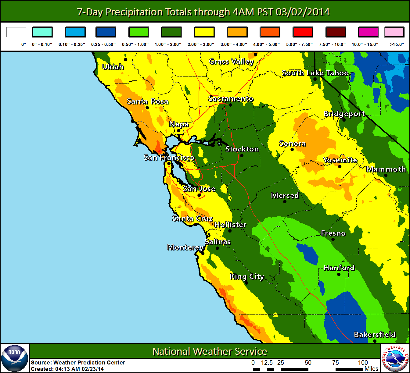
· Brief heavy rainfall will be possible Wednesday and Friday resulting in reduced visibility. This will lead to hazardous driving conditions. Please see attached image for rainfall totals through 4 am Sunday morning.
*Impact 2 (Drought):
· This rain will do little to improve the overall drought conditions across the area.
*Impact 3 (Wind):
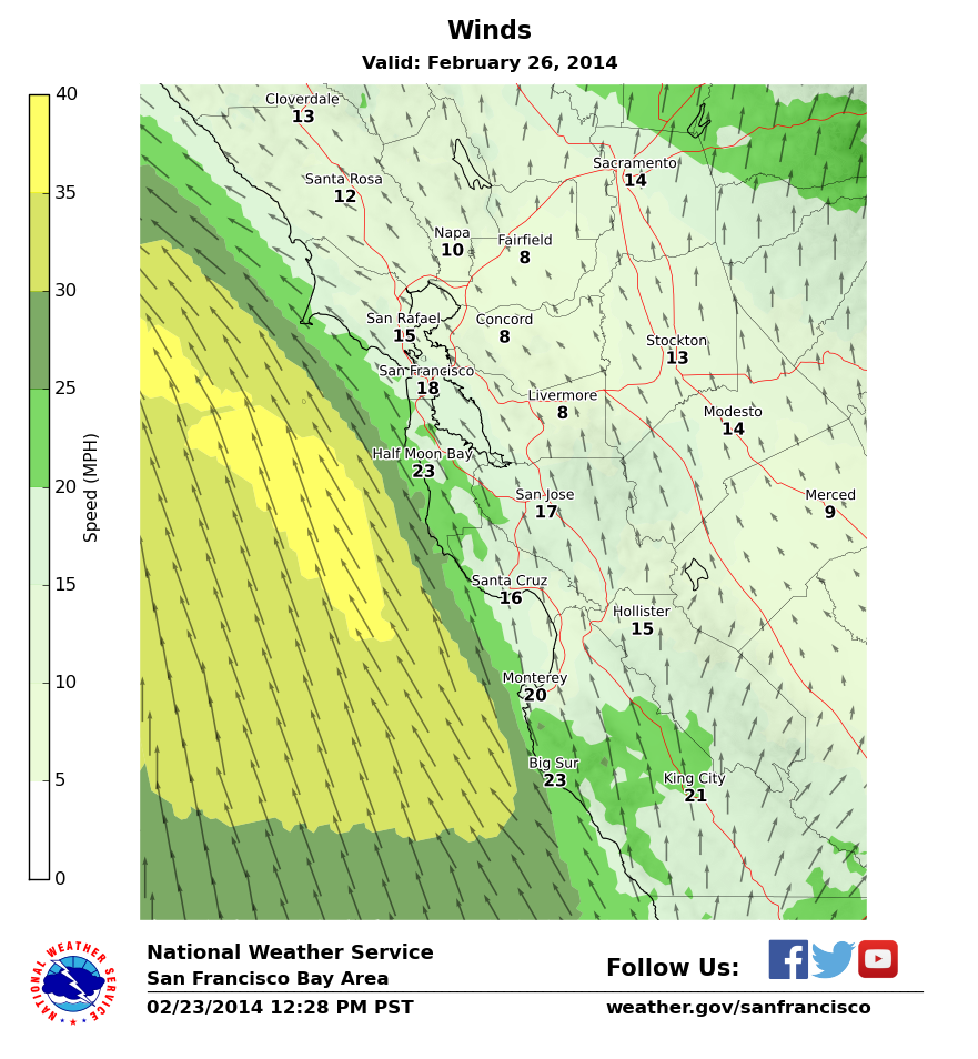
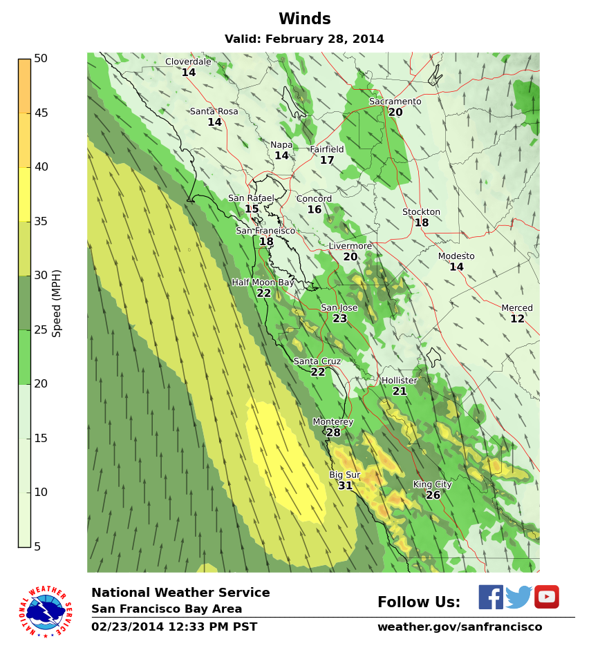
· South wind gusts between 20 and 30 mph on Wednesday with gusts to 40 mph on Friday. Downed trees and power lines will be possible. Please see attached images for possible wind speeds both Wednesday and Friday afternoon.


