Emergency vehicles can be seen at the early morning fire on El Camino Real
Photo credit: Alvarez Consuelo
South San Francisco, CA October 9, 2017
Two SSF Fires
In the early morning hours a South City neighbor reported hearing a loud popping and saw a fire erupt and immediately called 911. From his vantage point near the Dog Park he was able to capture this video CLICK HERE
“I was just being a good neighbor and saw the fire first hand when it started” our neighbor said “Glad I heard the sirens while I was talking to 911 dispatch. The fire crews put it out very quickly but don’t know if anybody was injured. Once I saw the white smoke I knew the firemen had control of the fire..”
Firedispatch.com had identified this location as 840 El Camino Real which is the recently closed Arby’s Restaurant building and listed this call at 78 minutes. Our South San Francisco Fire Chief Gerry Kohlman provided this information in response to our questions:
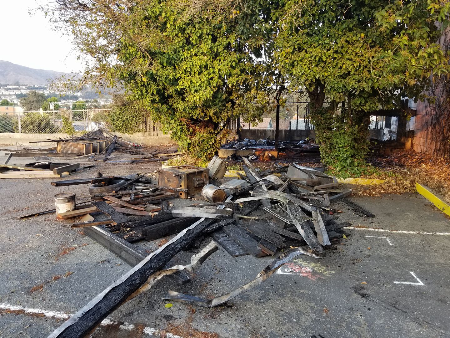
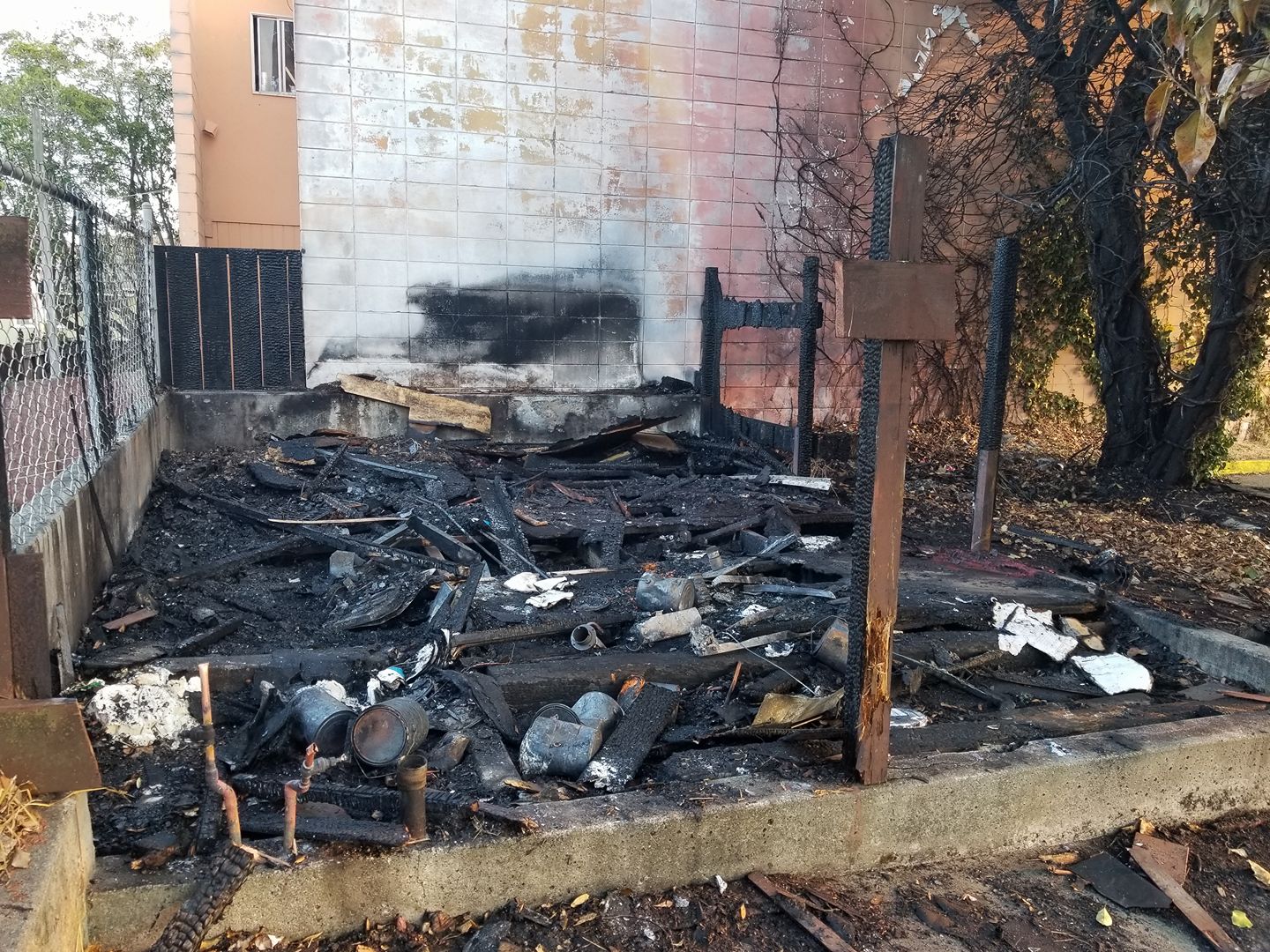
‘The fire at 840 ECR was actually behind 800 ECR and was a combination of a shed and vegetation. Crews extinguished fire before it extended into the All Seasons Hotel. Although arson is always considered, is not suspected in this case. It may have been accidental or human caused, but damage to area of suspected origin was significantly damaged. SSFPD and SSFFD staff worked together on the incident.’
An earlier fire was reported by Firedispatch.com at 4:32AM at 687 El Camino Real, which would be home to the Parmigiano Pizza and Burger, on the corner of Orange and El Camino Real. “Fire was caused by electrical failure and once fire crews exposed charred area, fire was contained to area of origin” SSFFD Chief Kohlman said “The damage is approximately $1,000 to $2,000.”
If you hear fire sirens and would like more information in real time, check out Firedispatch.com HERE by using the pull down menu under LOG you will find South City Fire events.
UPDATE: 10/9/2017 6pm Photos sent by Kevin Walsh

Remnants of the fire behind 840 ECR
Photo Credit: Kevin Walsh

Remnants of the fire behind 840 ECR
Photo credit: Kevin Walsh
California on Fire!

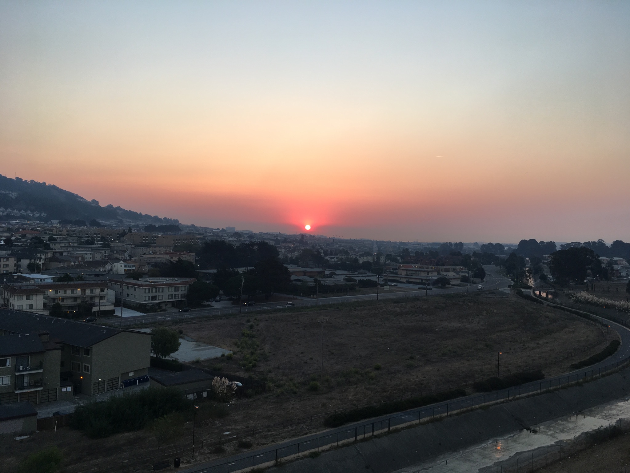
Smokey skies create a surreal sunrise in South San Francisco
Photo Credit: ROGER CAIN
UPDATE: This is a great resource for checking fires in CA, use the left column to gain more info for the specific fire incident. HERE
In addition reports of wildfires blowing up in Napa, Sonoma, and Mendo counties have brought heavy smoke to our region. San Mateo County Alert System sent out this message at 1:00AM:
Please expect a strong smell of smoke due to the Napa fire. Multiple reports have come in indicating that the smoke from the Napa fire has blown into San Mateo County. If you see fire in your area, believe the smoke smell is from a local source or you believe you are in any danger, please call 911. OES13
The South San Francisco Fire Department has deployed fire personnel to the northern counties as Chief Kohlman explained:
SSFFD Engine 61 with a crew of four responded with four other engines and a strike team leader at about 0630 this morning. Initially, they were dispatched to Napa County and have since been diverted to Santa Rosa and are actively engaged in fighting fire in the neighborhoods.
We also have fire personnel in Puerto Rico. “Our fire captain will return from his federal incident management team assignment in Puerto Rico on October 15th if all goes as planned.” Fire Chief Kohlman said.
To get updates on the fires in Napa/Mendo/Sonoma and beyond, CLICK HERE.
| Tubbs Fire: | Updated: October 09, 2017 11:29 am | |
| County: | Napa County | |
| Location: | off of Hwy 128 and Bennett Ln, Calistoga | |
| Acres Burned – Containment: | 25,000 acres | |
| Nuns Fire: | Updated: October 09, 2017 12:03 pm | |
| County: | Sonoma County | |
| Location: | Hwy 12, north of Glen Ellen | |
| Acres Burned – Containment: | 5,000 acres | |
| Patrick Fire: | Updated: October 09, 2017 11:26 am | |
| County: | Napa County | |
| Location: | off Patrick Rd, west of Napa | |
| Acres Burned – Containment: | 3,000 acres | |
| Atlas Fire: more info… | Updated: October 09, 2017 11:26 am | |
| County: | Napa County | |
| Location: | off of Altas Peak Rd, south of Lake Berryessa | |
| Acres Burned – Containment: | 25,000 acres | |
| Evacuation Info: | Napa County Sheriff Evacuation Information | |
| Redwood Complex (includes Redwood Fire and Potter Fire): more info… | Updated: October 09, 2017 11:21 am | |
| County: | Mendocino County | |
| Location: | North of Hwy 20, west of Mendocino National Forest, south of Black Bart | |
| Acres Burned – Containment: | 10,000 acres | |
| Evacuation Info: | Evacuations are in place for areas of Potter Valley, the Community of Redwood Valley and Golden Rule.Evacuation centers: Ukiah High School and Willits City Hall. The large animal evacuation center is at Ukiah Fair Grounds. |
|
| Cherokee Fire: more info… | Updated: October 09, 2017 12:07 pm | |
| County: | Butte County | |
| Location: | off Cherokee Road and Zonalea Lane, Oroville | |
| Acres Burned – Containment: | 4,000 acres | |
| Evacuation Info: | Evacuation orders issued for Red Tape Rd. West to the Sand Mine. Table Mtn Ranch east of Table Mtn Rd. Table Mountain Blvd from the Cottonwood Rd. to Hwy 70, Table Mountain Ranch & Coal Canyon & Roads off of those streets. Evacuation Warnings: East side of Cherokee Rd. from Red Tape Rd. to Derrick Rd. All of Coal Canyon Rd. Nelson Ave. from the bridge over the Forebay west to Wilbur Rd. |
|
| McCourtney Fire: | Updated: October 09, 2017 6:36 am | |
| County: | Nevada County | |
| Location: | McCourtney Rd and Hwy 20, Grass Valley | |
| Acres Burned – Containment: | 200 acres | |
| Point Fire: more info… | Updated: October 09, 2017 1:43 pm | |
| County: | Calaveras County | |
| Location: | Hwy 26 and Higdon Rd., West Point | |
| Acres Burned – Containment: | 130 acres – 10% contained | |
| Sulphur Fire: | Updated: October 09, 2017 11:38 am | |
| County: | Lake County | |
| Location: | off Hwy 20 and Sulphur Bank Road, Clearlake Oaks | |
| Acres Burned – Containment: | 2,000 acres | |
| Lobo Fire: more info… | Updated: October 09, 2017 11:50 am | |
| County: | Nevada County | |
| Location: | near Lone Lobo Trail, Rough and Ready | |
| Acres Burned – Containment: | 700 acres | |