South San Francisco, CA February 26, 2019
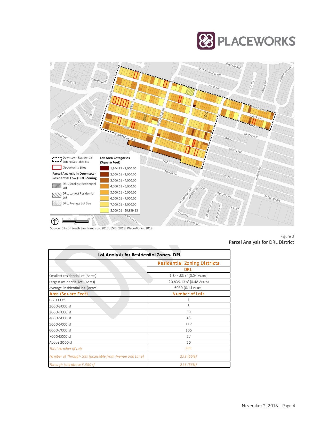
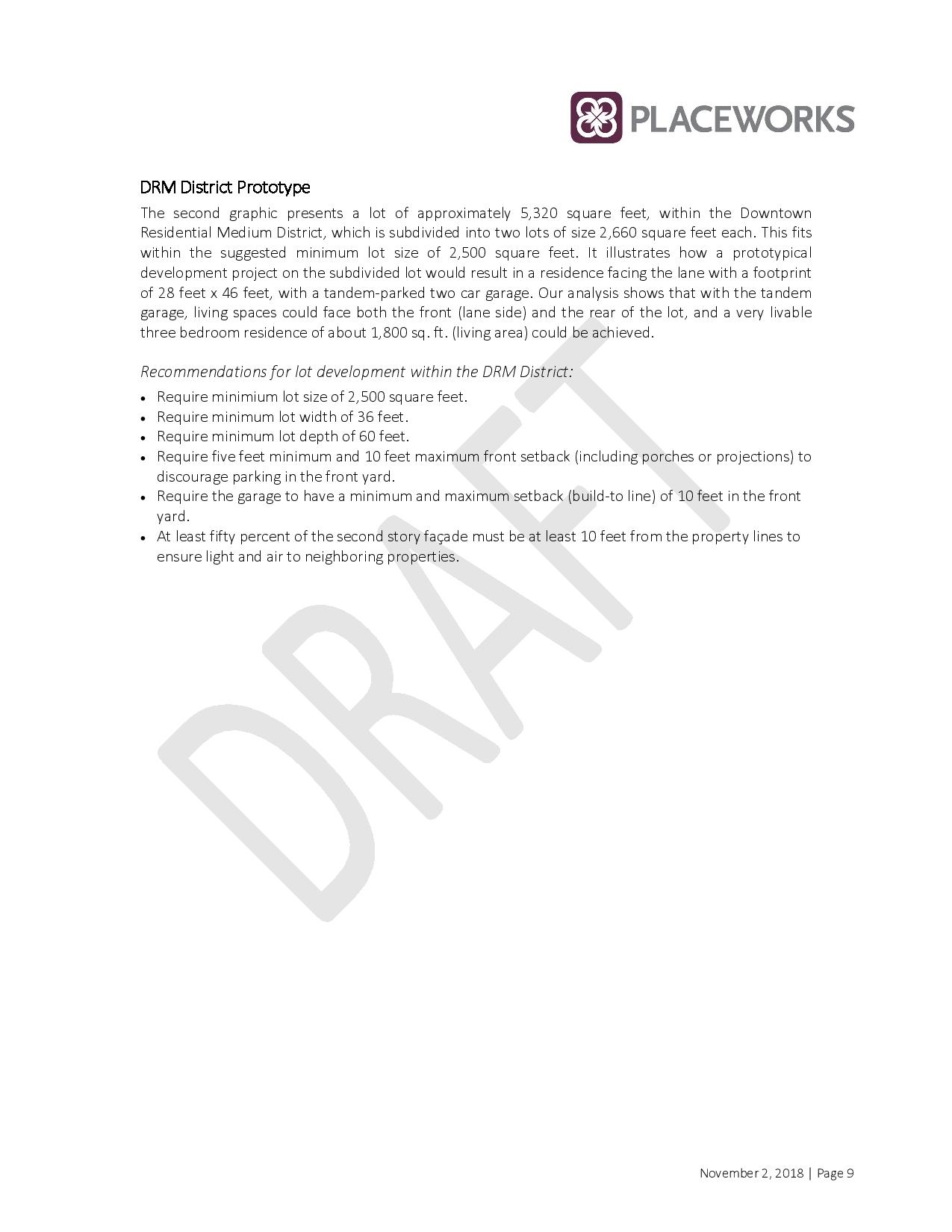
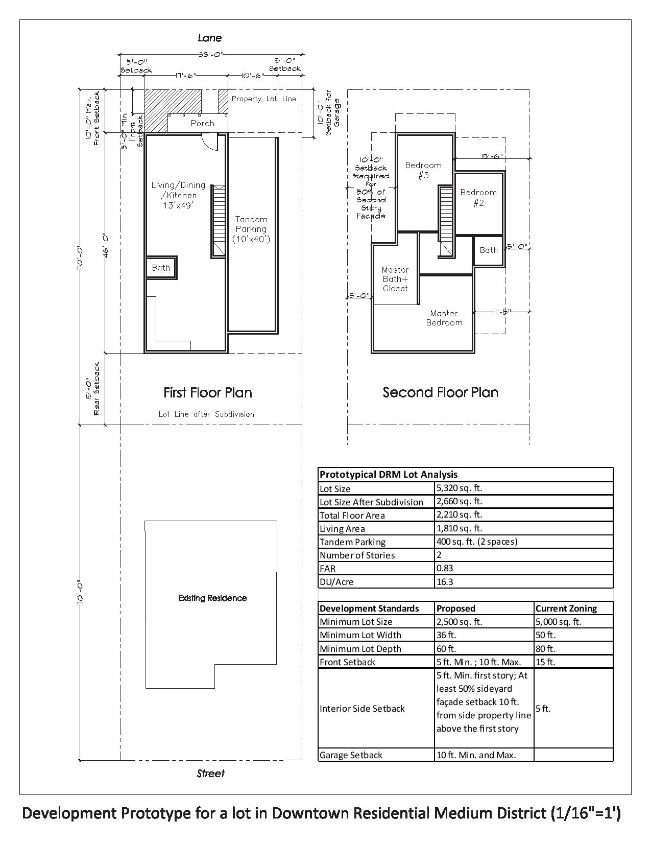
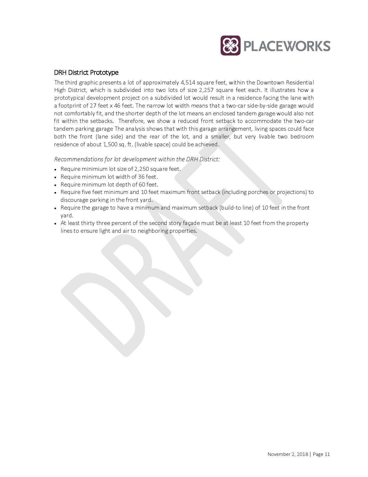
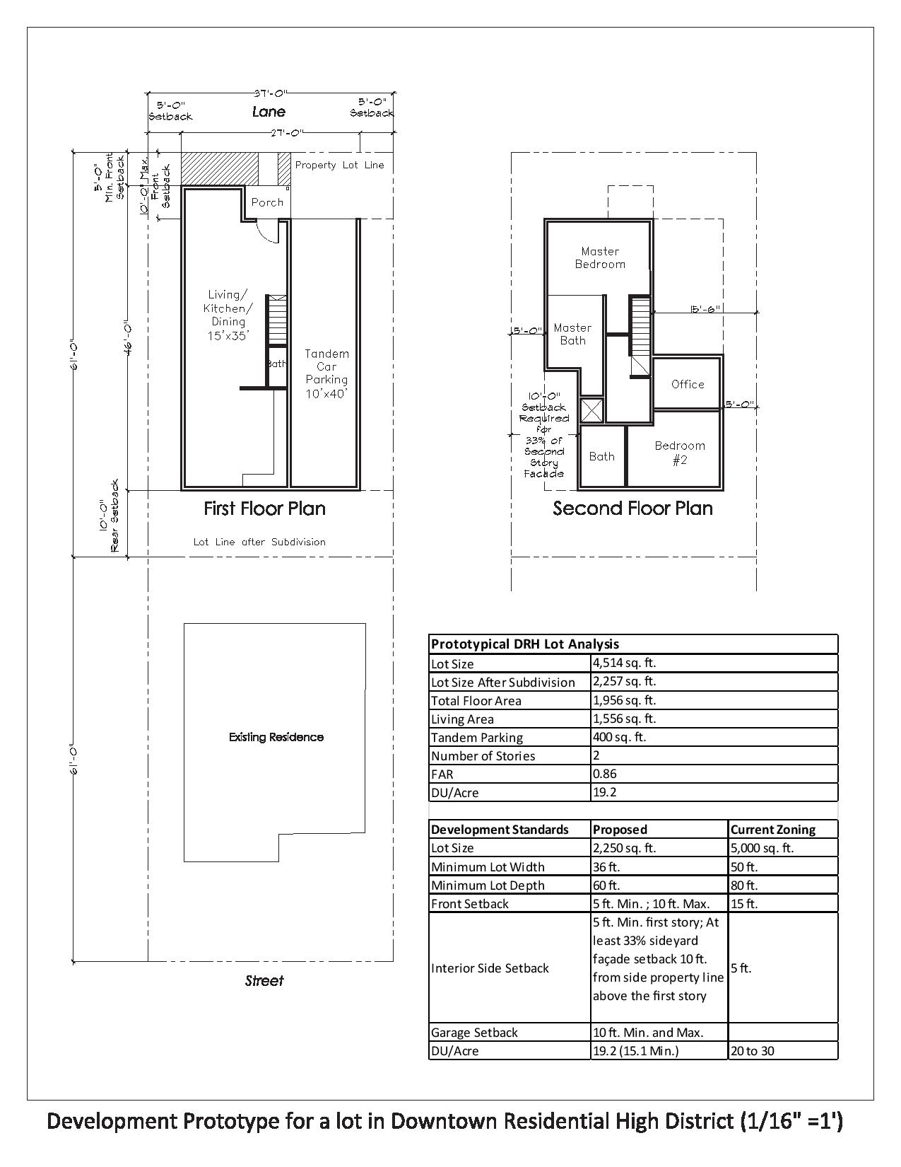
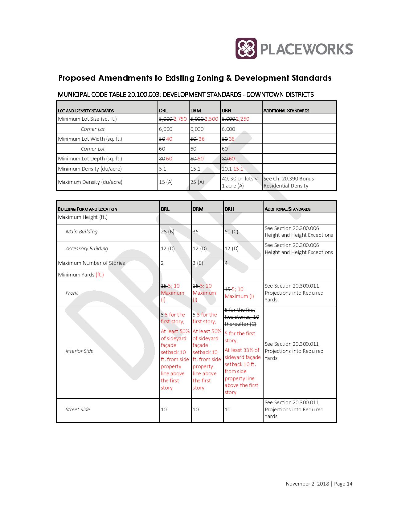
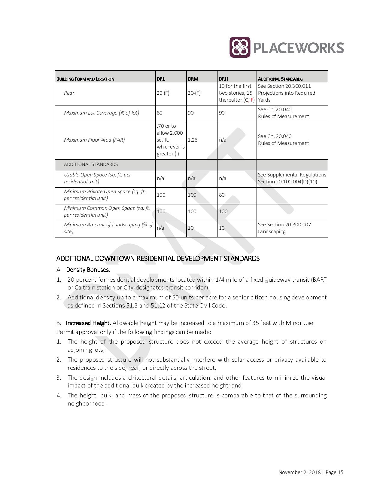
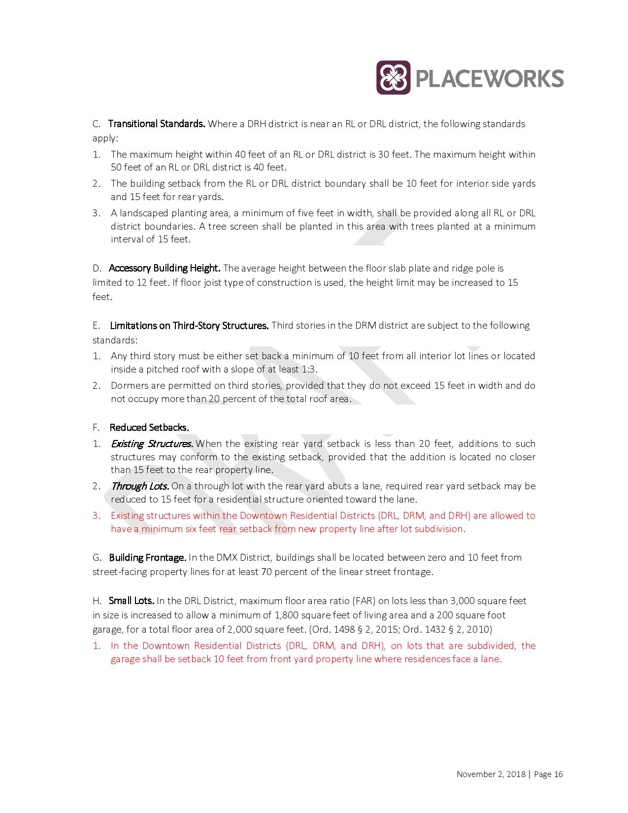
The City will be hosting a ‘workshops’ on proposed zoning changes that would allow residential homeowners in an expanded ‘downtown’ districts to split there lots, thereby allowing “homeowners with flexibility to divide and sell a portion of their lot with the idea to provide more opportunities for ownership & single-family housing development”.
DATES: Tues Feb 26th and Tues March 5th Drop in from 5-7pm 315 Maple Ave
MORE INFO 650.877.8535 / planning@ssf.net
We will update with more information as it becomes available. If you have insights/info to share with us please contact us CLICK HERE
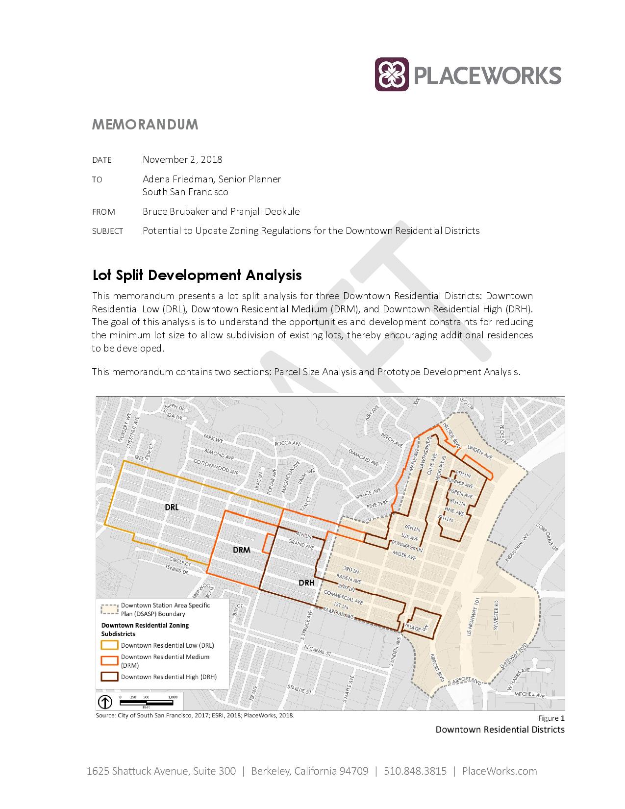
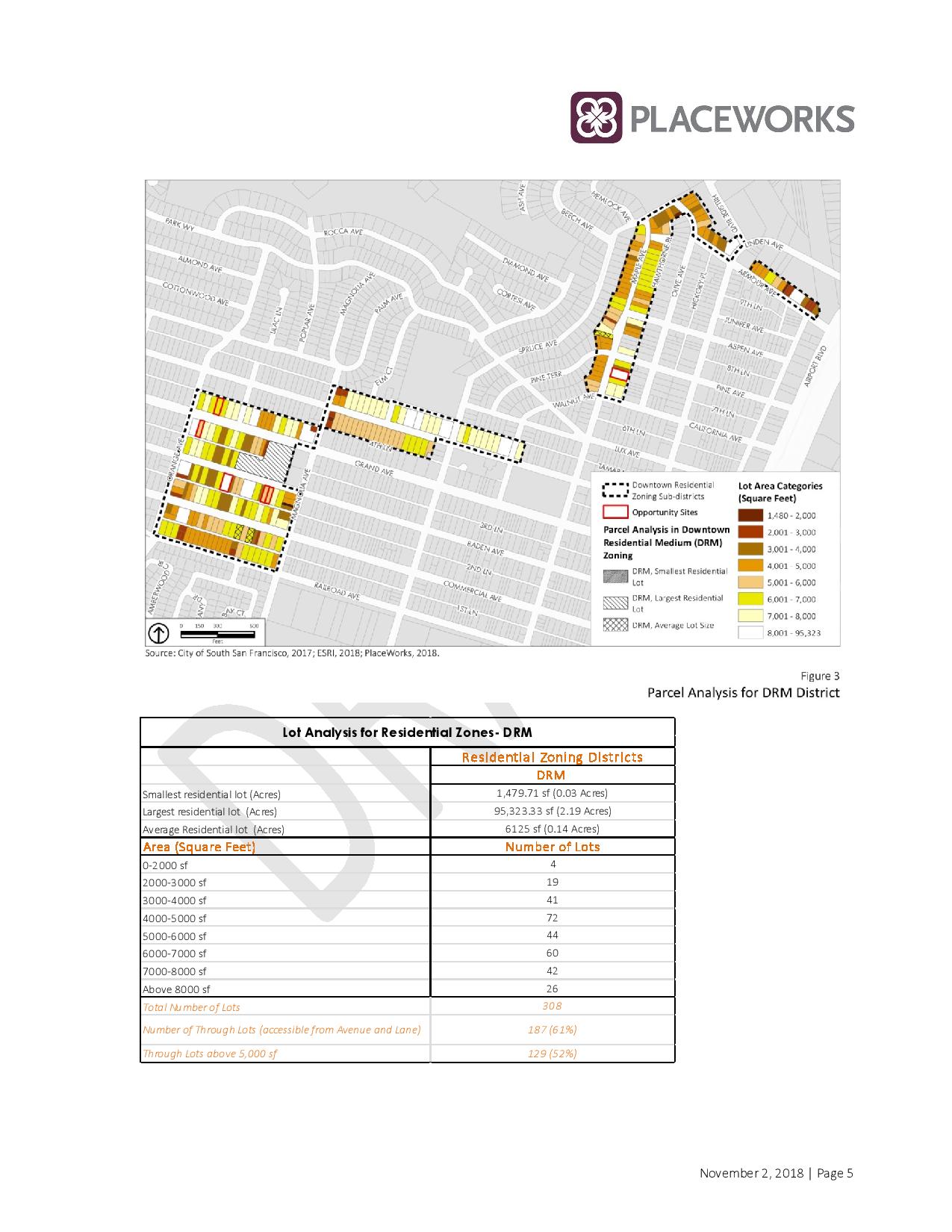
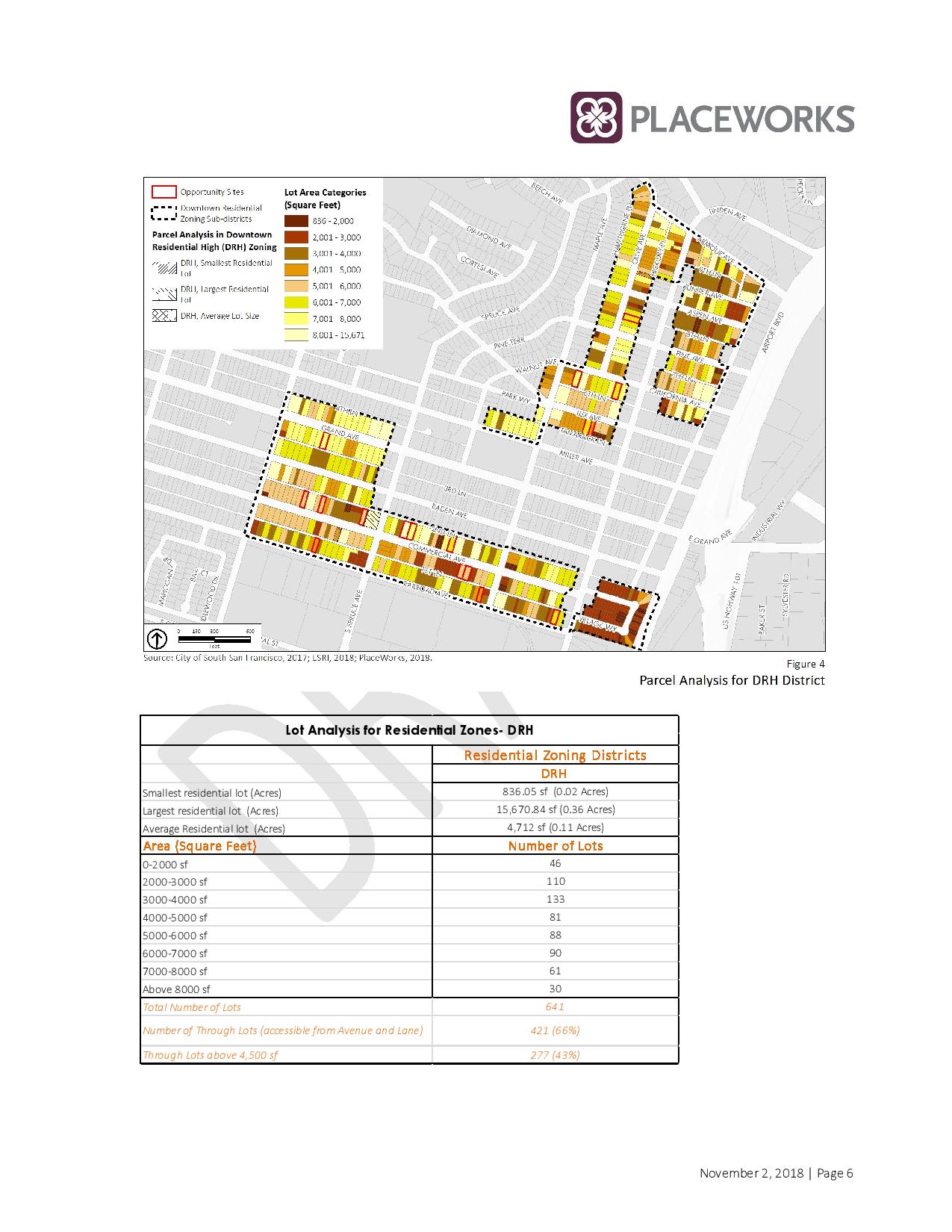
While most think of the ‘Downtown’ area boundaries as Airport/Spruce/Grand/ this new map shows three different ‘downtown districts’ as identified on this map below:
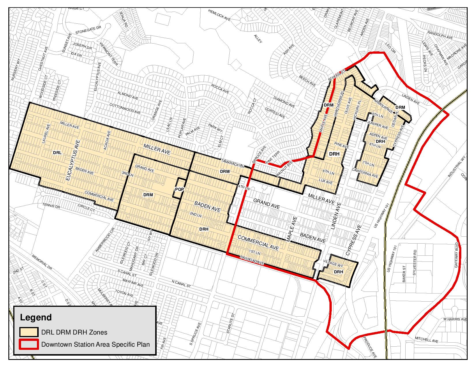
Billy Gross, South San Francisco’s Senior Planner, shared this additional information, which we appreciate as we try to follow the changes being proposed:
Following are all of the zoning districts in the Downtown District Zoning (Chapter 20.100) and the Downtown Station Area Specific Plan Zoning (Chapter 20.280). The links I’ve included in the previous sentence will take you to sections that include the specific district definitions as well.
Downtown Transit Core (DTC)
Grand Avenue Core (GAC)
Downtown Residential Core (DRC)
Transit Office/R&D Core (TO/RD)
Linden Neighborhood Center (LNC)
Linden Commercial Corridor (LCC)
Downtown Mixed-Use (DMX)
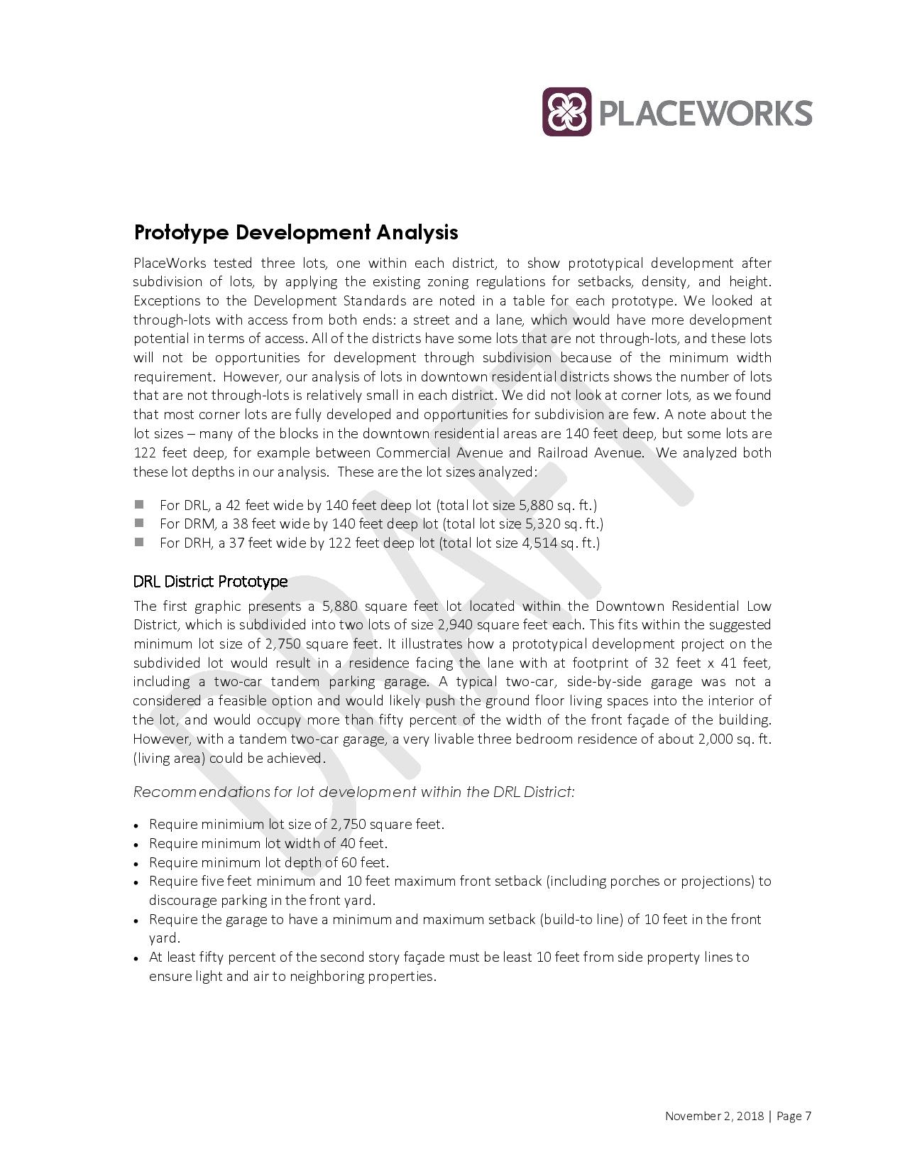
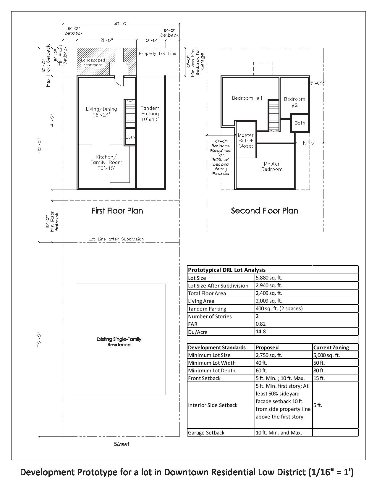
Downtown Residential Low (DRL)
Downtown Residential Medium (DRM)
Downtown Residential High (DRH)
Per the Downtown District Zoning Chapter 20.100 this identifies how many ‘units’ can be legally
DMX Downtown Mixed-Use. This district is intended to provide for a mix of residential development, retail, and office uses as well as hotels and other commercial uses oriented toward a more regional market. The maximum base FAR is 1.5 and the maximum density is 40 units per acre. This district conforms to the Downtown Mixed Use area designated in the General Plan.
DRL Downtown Residential Low. This district is for detached and attached single-unit residential development with densities from 5.1 to 15 units per acre as well as care facilities, family day care, park and recreation facilities, and civic and institutional uses such as schools and places for community assembly that may be appropriate in a residential environment. Retail and office development and hotels are not permitted consistent with the General Plan.
DRM Downtown Residential Medium. This district is to provide for a full range of housing types at densities ranging from 15.1 to 25 units per acre. Consistent with the General Plan, there is a minimum residential density of 15.1 units per acre; retail and office development and hotels are not permitted.
DRH Downtown Residential High. This district is for multi-unit development at densities from 25.1 to 40 units per acre with a maximum of 30 units for lots smaller than a half acre. Retail and office development and hotels are not permitted. (Ord. 1498 § 2, 2015; Ord. 1432 § 2, 2010)
Per the Downtown District Zoning Chapter 20.280 ;
The following sub-districts are established within the Downtown Station Area Specific Plan District. Sub-district boundaries are shown on the official Zoning Map. The sub-districts west of US 101 are referred to as the “Downtown” and the sub-districts located east of US 101 are referred to as the “Eastern Neighborhood.” The purpose of each sub-district is as follows:
- Downtown Transit Core (DTC). The Downtown Transit Core sub-district is focused within a ¼ radius of a point just east of US 101 at East Grand Avenue. This location corresponds to the planned extension of the Caltrain Station and accompanying pedestrian/bicycle rail undercrossing. It is intended to provide sites for mixed-use development at high intensities in proximity to the Caltrain Station. It encourages active ground floor uses and high intensity development that will generate pedestrian traffic in the area. The Downtown Transit Core sub-district flanks the Grand Avenue Core sub-district which will be the epicenter of Downtown commercial uses. The Downtown Transit Core District, will provide additional population and activities to support Grand Avenue uses, increase Caltrain transit ridership, and provide housing with high amenity value for new residents.
- Grand Avenue Core (GAC). The Grand Avenue Core sub-district extends along Grand Avenue from Airport Boulevard on the east to Spruce Avenue on the west. It is intended to be the “main street” of the Downtown. This sub-district will build on the history and layout of the old Downtown while providing additional capacity for residential and commercial uses. Located directly west of the relocated Caltrain Station, the rail undercrossing, and the East of 101 Office/R&D District, the Grand Avenue Core sub-district will benefit from improved accessibility to employment east of the rail line as well as increased residential populations in the Downtown. The Grand Avenue Core sub-district is intended to provide a nearly continuous retail frontage with high density residential above, although at somewhat lower densities than the adjoining Downtown Transit Core district.
- Downtown Residential Core (DRC). The Downtown Residential Core sub-district is located in the Downtown in the remainder of the Pedestrian Priority Zone not defined as Grand Avenue Core or Downtown Transit Core. This sub-district is defined by Tamarack Lane on the north, Second Lane on the south, Spruce Avenue on the west, and Airport Boulevard on the east. This district is intended to provide for high density residential neighborhoods near the center of Downtown and within about ½ mile of the Caltrain Station. This sub-district allows, but does not require commercial uses on the ground floor. This sub-district will provide additional residential opportunities within an area that will have significant pedestrian and bicycle improvements to allow easy access to Caltrain and the employment center east of US 101.
- Transit Office/R&D Core (TO/RD). The Transit Office/R&D Core sub-district is located just east of the Caltrain tracks in an area bounded by East Grand Avenue on the north, Gateway Boulevard on the east, Poletti Way and US 101 on the west, and S. Airport Boulevard on the south. This sub-district is intended to provide a location for the highest intensity office or R&D uses. Suited to headquarters or other office type uses that do not include significant manufacturing, the sub-district offers the opportunity for locating high intensity uses in immediate proximity to the Caltrain Station. In addition, with the relocation of the Caltrain Station and construction of a pedestrian and bicycle rail undercrossing, this sub-district will provide convenient access to Grand Avenue and the surrounding areas and will support commercial revitalization.
- Linden Neighborhood Center (LNC). The Linden Neighborhood Center is located north of Grand Avenue on Linden Avenue between Ninth Lane and California Avenue. This sub-district includes some existing local-serving businesses which will form the foundation for a cluster of retail, services and amenities that can serve the surrounding residential neighborhoods. The Linden Neighborhood Center designation will encourage mixed use development, with retail uses at the ground floor and residential above.
- Linden Commercial Corridor (LCC). The Linden Commercial Corridor lies north of Grand Avenue between California Avenue and Sixth Lane, and south of Grand Avenue between Second Lane and Railroad Avenue. This sub-district will allow but will not require ground level mixed use, neighborhood-serving and retail uses within otherwise residential or commercial areas.
- Other Downtown Districts. See Downtown Districts Chapter 20.100 and Employment Districts Chapter 20.110 for information on unchanged land use districts found in the Specific Plan and the larger Downtown area, including Downtown Residential High, Downtown Mixed Use, Downtown Residential Medium, Downtown Residential Low, Business Commercial, and Mixed Industrial. (Ord. 1498 § 2, 2015)
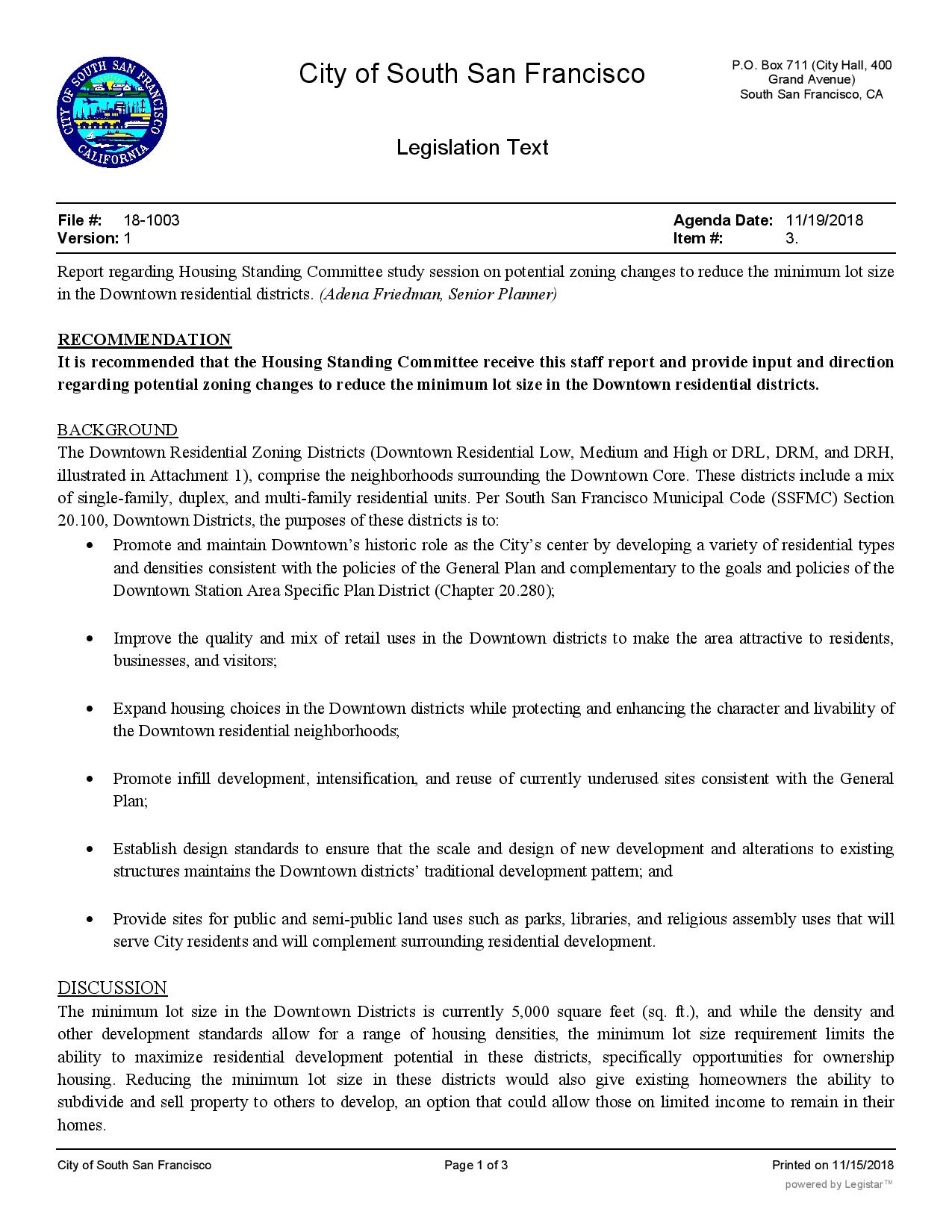
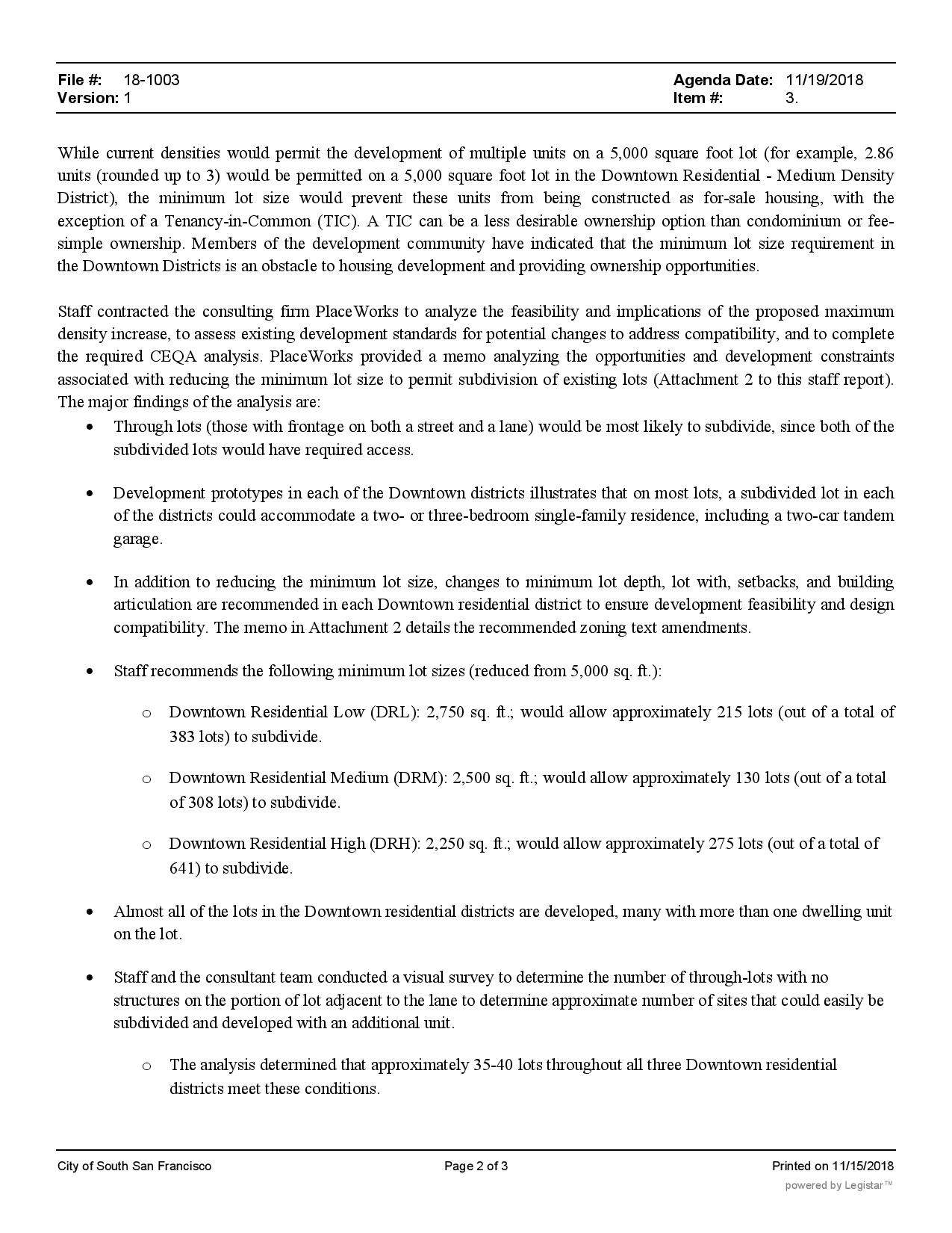
what is the update on this ?
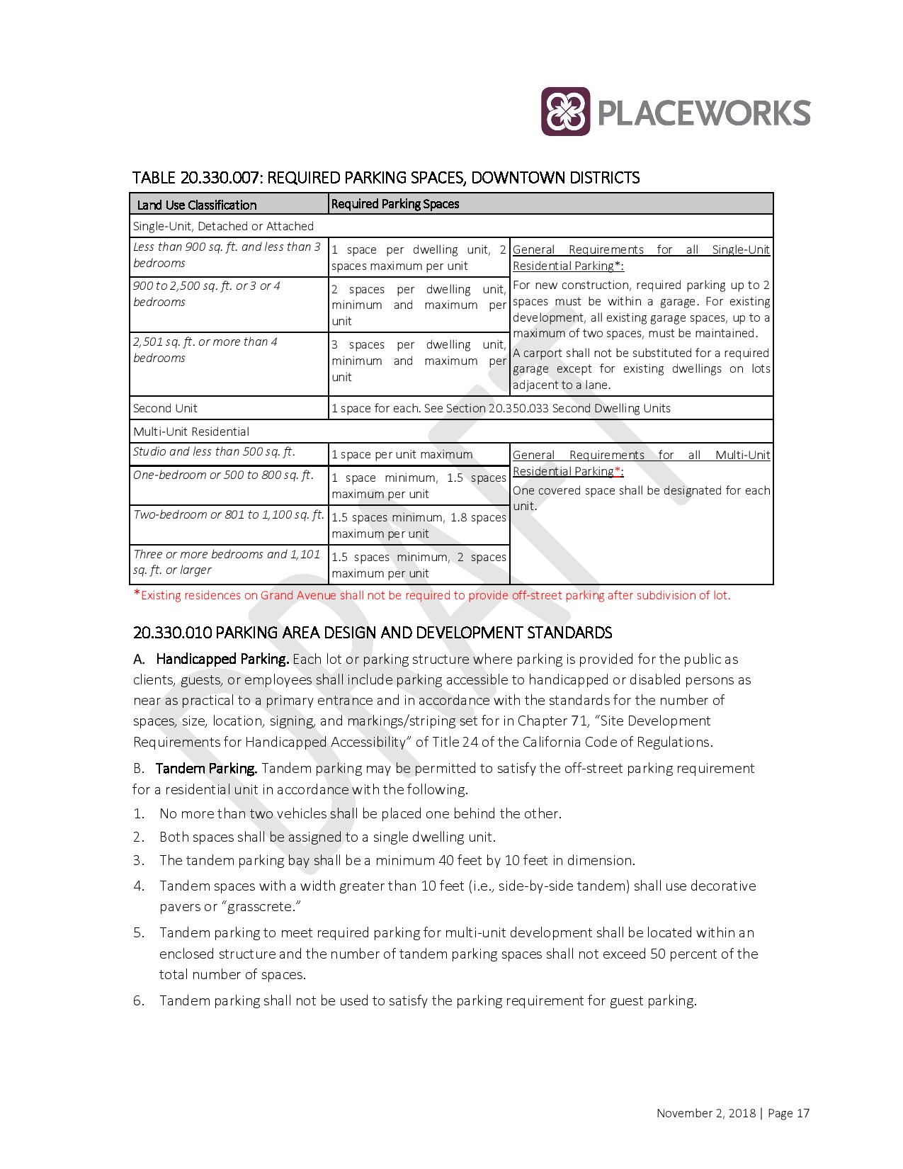
I agree, just the other night we went to Grand Ave and the parking was full on the street AND in the garage! I don’t go out much but seeing that parking sign said “FULL” in the garage was so crushing. I love housing people, I really do… but people love the convenience and that means cars.Too many cars.
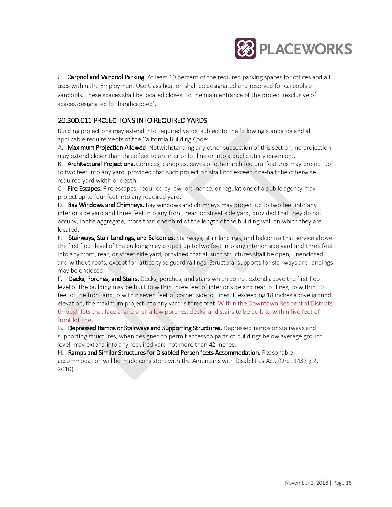
Our city is overcrowded as it is and there continues to be no planning for increased traffic and parking. Our city leaders believe that everyone is going to use public transportation which has not been proven and which is not always convenient. Even if the original house has a garage that is used to park cars, and the new construction has a garage used for that purpose and not to house additional family members or tenants, there still will be extra cars on the street. Street parking is bad enough but on trash pick-up day it is even worse. I used to be able to park in front of my house but now find it very hard to do.
Our leaders need to be reminded that we are South San Francisco NOT SAN FRANCISCO. If I wanted to live in San Francisco, I would have stayed there. I am already tired of looking at all of these tall buildings. We need more open space. I don’t even want to hear our city leaders ask for more tax dollars; tired of hearing them cry “poor.”