South San Francisco, CA June 10, 2019
THIS NOTICE HAS BEEN SENT BY THE SMC ALERT SYSTEM FOR TODAY, HOWEVER, THE INFORMATION IS A VALUABLE RESOURCE TO ARCHIVE FOR REFERENCE WHEN WE NEED IT.
Tho following advisory was prepared by the National Weather Service and forwarded to all users of the SMC Alert system by the San Mateo County Sheriff’s Office of Emergency Services.
|
|
Continued Widespread Heat Event Into the Early Part of the Work Week
National Weather Service – SF Bay Area/Monterey Issued: 5:10 pm PDT, 09 June 2019 Point of Contact: 24/7 OPS – EM: 831-656-1717 | Media: 831-656-1724 |

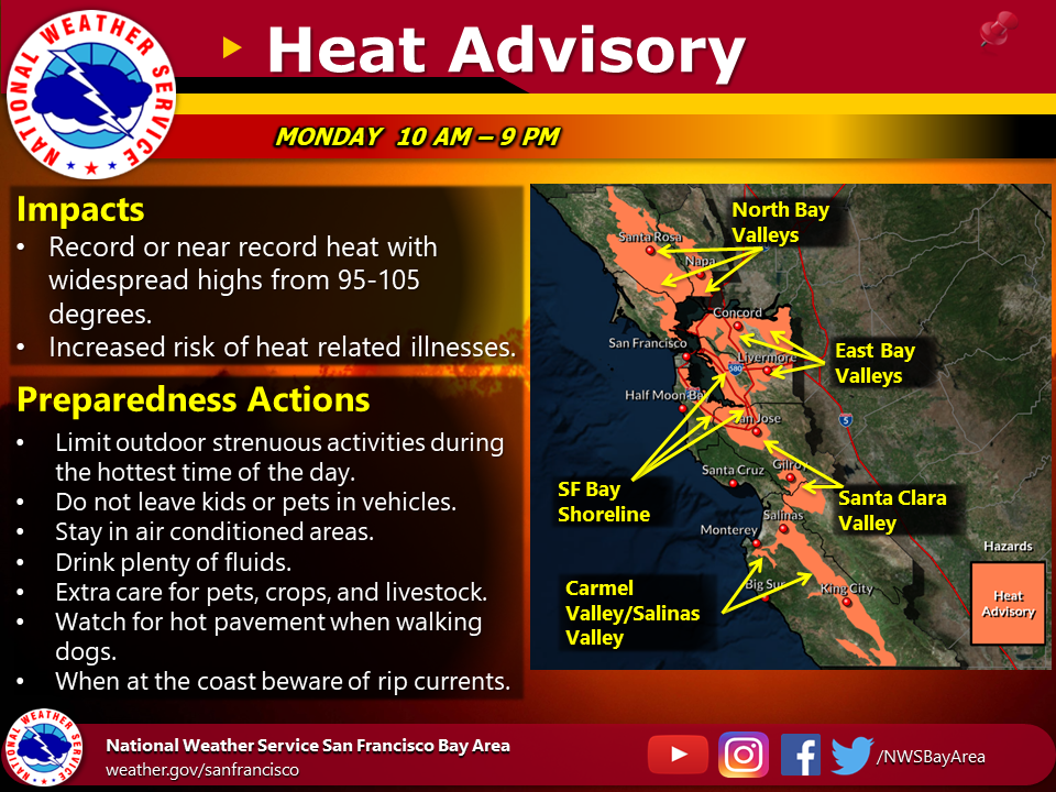
Key Points – Expected Impacts
· Very warm to hot conditions will continue across the San Francisco Bay Area and most of the Monterey Bay Area through Monday. Coastal temperatures on Monday are forecast to be similar to what occurred on Sunday, but inland areas are forecast to be a few degrees warmer.
· Moderate to high Heat Impacts are expected on Monday, especially for those sensitive to heat.
· Cooling is forecast near the coast and in the coastal valleys by Tuesday, but most inland areas will remain hot.
· Cooling will develop in all areas by Wednesday.
· Offshore winds will be light for the remainder of this Heat Event. Thus, Fire Weather Concerns have subsided.
Weather Summary
A warming trend will continue into Monday for inland areas as high pressure continues to strengthen over the region. Inland highs on Monday are forecast to range from 95 to 105. Most coastal areas will remain very warm on Monday due to continued light offshore flow, with highs near the coast forecast to range from 80 to 95. A southerly surge is forecast to begin along the Big Sur Coast on Monday, as a shallow marine layer with fog advances from south to north. Thus, Big Sur will likely see some relief from the heat on Monday. The southerly surge will continue northward up the coast on Monday night and a shallow marine layer and light onshore flow are expected to be in place in all coastal areas by Tuesday morning. Thus, all coastal areas are forecast to experience significant cooling on Tuesday. Less substantial cooling is expected along the San Francisco Bay Shoreline and in the coastal valleys on Tuesday. The inland valleys and hills will remain very warm to hot on Tuesday. All areas are forecast to cool by Wednesday as the marine layer deepens and onshore flow increases.
For the latest forecast updates, visit www.weather.gov/BayArea
For all current watches/advisories/warnings/, https://www.wrh.noaa.gov/hazardSummary/?wfo=MTR