Overview
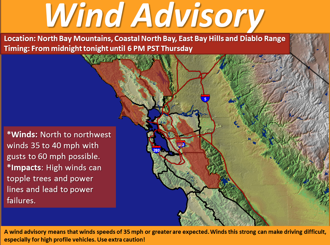
A mid/upper level storm system will sweep through the Central Coast later today. Behind this system, strong and gusty northerly winds will develop across the coastal waters tonight and then over the Coastal North Bay, North Bay Mountains, and the East Bay Hills and Diablo Range during the overnight hours. Strong to very strong northerly winds will persist through at least Thursday afternoon.
CONFIDENCE
· High: Over the coastal waters.
· Moderate to High: Inland across the North Bay and East Bay locations.
TIMING
· Wind speeds increase late tonight over the coastal waters and then over the Coastal North Bay and hills/mountains of the North Bay and East Bay during the early morning hours on Thursday.
LOCATIONS
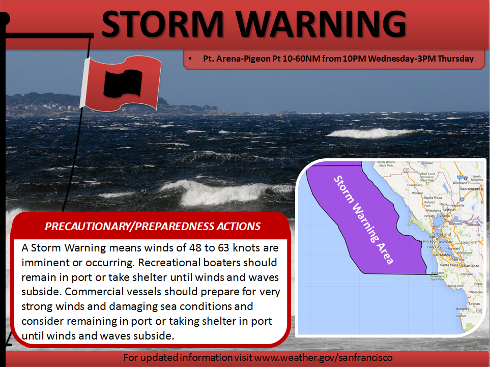
· The northern offshore coastal waters from Point Arena to Pigeon Point will experience the strongest wind speeds. The remaining coastal waters can expect strong to very strong offshore flow as well.
· Strong and gusty winds across the Coastal North Bay and the hills/mountains of the North and East Bay.
IMPACTS
*Hazards:
· Wind Advisory: Coastal North Bay, North Bay Mountains, and East Bay Hills & Diablo Range.
· Storm Warning: Point Arena to Pigeon Point 10-60 nautical miles out.
· Gale Warning: Pigeon Point to Piedras Blancas 10-60 nautical miles out and the near-shore waters from Point Arena to Point Pinos.
· Small Craft Advisory: Remainder of the Bays and Coastal Waters along the Central Coast.
More detailed view of ongoing Hazards: http://www.wrh.noaa.gov/lox/fastpage/wwa_bc.php?wfo=mtr#MTR
*Impact 1 (Winds and Waves – Coastal Waters) :
· North to northwest winds with speeds increasing to 30 to 40 knots late tonight with frequent storm force wind gusts to 50 knots across the northern offshore waters. Wind speeds of 25 to 35 knots with gusts to 45 knots in the areas within the Gale Warning.
· Steep wind waves and rough seas are also expected, especially across the offshore waters where combined seas of 10 to 22 ft will be possible.
*Impact 2 (Winds – Inland):
· North to northwest winds of 35 to 40 MPH with gusts up to 60 MPH possible over the hills and mountains of the North Bay and East Bay.
· North to northwest winds of 25 to 35 MPH with gusts up to 45 MPH possible over the Coastal North Bay.
*Impact 3 (Elevated Fire Weather Concerns):
· The strong offshore flow that will develop across the North Bay and East Bay hills/mountains will create elevated fire weather concerns. These strong winds will combine with low relative humidity values and dry fuels. Fire weather partners should closely monitor weather conditions, especially Thursday morning through late Thursday evening. Click here for the latest fire weather forecast.

