South San Francisco, CA November 4, 2019 Press Release
{UPDATE EDIT 11/6/2019 1:45pm per new release per Peter Feng, SSFUSD}

The South San Francisco Unified School District (SSFUSD) board of trustees has chosen a new map for district elections that begin in 2020. (CLICK HERE)
SOUTH SAN FRANCISCO, CA—The South San Francisco Unified School District (SSFUSD) board of trustees has identified a new map for district elections that begin in 2020.
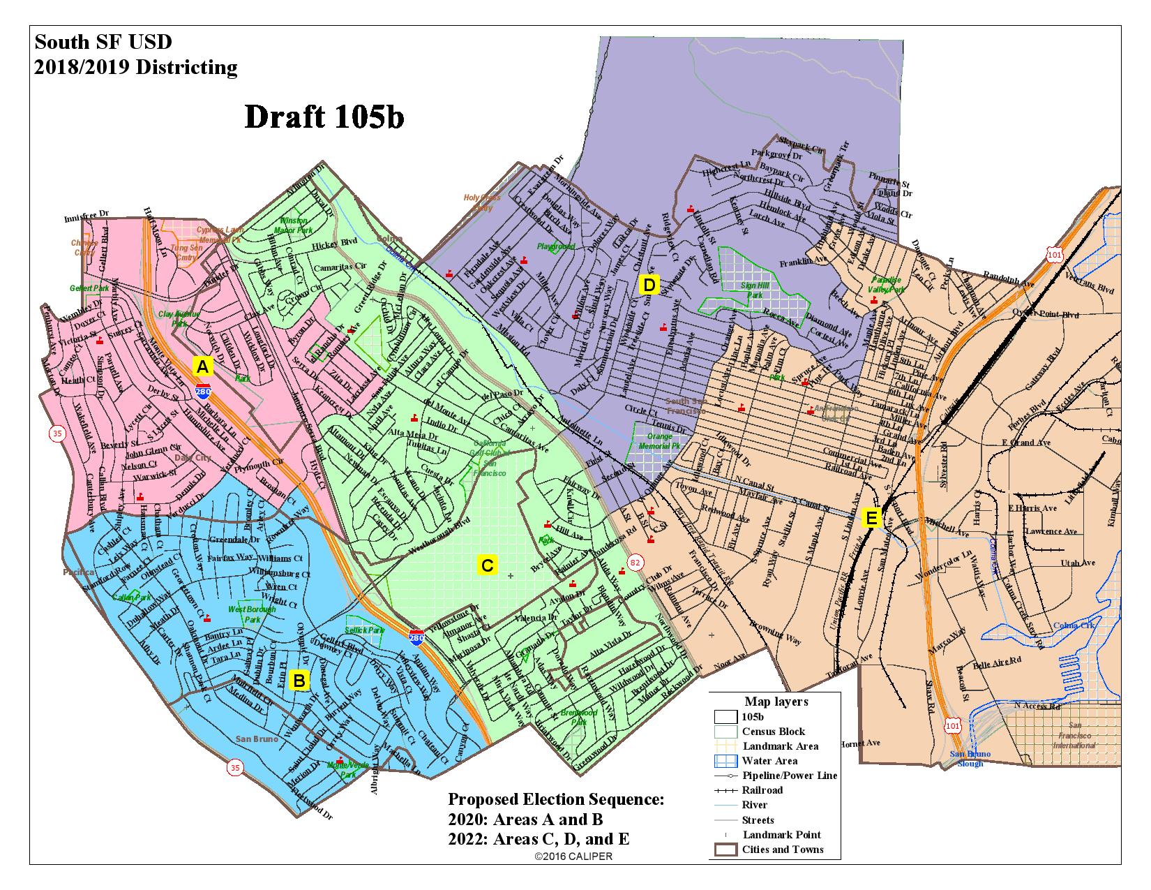
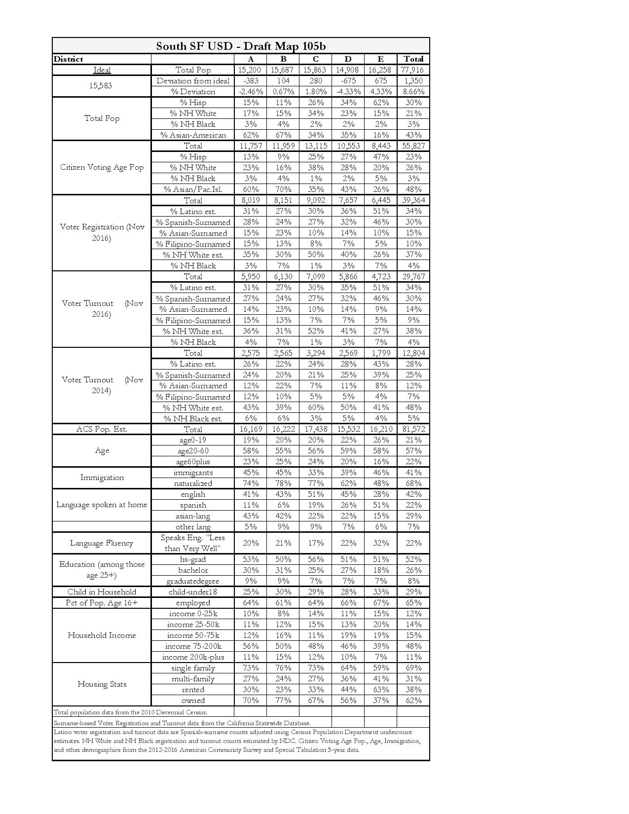
The map, which encompasses five districts with a total population of 77,916 individuals, must still be approved by the school board at its November 14<https://webmail.ssfusd.org/
It is the culmination of a two-year process to move the selection of school board members from a citywide vote to local, district elections.
“Our trustees have tried to be as equitable and transparent as possible” said SSFUSD Superintendent Dr. Shawnterra Moore. “Each of the five districts contains approximately the same number of residents as the others.”
District A occupies the northwest section of South San Francisco and extends east from Skyline Boulevard into a portion of the Serra Highlands neighborhood and north to Serramonte Boulevard.
District B sits below District A and also extends east from Skyline Boulevard to encompass the Westborough neighborhood, ending at the 280 freeway.
District C’s western border adjoins both Districts A and B and extends from the Winston Manor neighborhood in the north to the Brentwood neighborhood in the south.
District D sits astride Orange Avenue and encompasses the Sunshine Gardens and Sign Hill neighborhoods, ending north of Hillside Boulevard.
District E stretches across the neighborhoods of Orange Park, Lindenville, and Downtown to Paradise Valley in the north and ends all the way at the bay.
Of the 77,916 residents living within the five districts, 55,827 are of voting age, and 39,364 are registered voters, according to figures from the November 2016 election.
“The selected map blended the best elements of two community-submitted maps,” SSFUSD Board President John Baker said. “I think the process demonstrated that our community members understand our neighborhoods and school communities better than any demographer possibly could.”
A total of four maps were eligible for the school board’s consideration.
Two were submitted by residents, and two were proposed by the National Demographics Corporation, which SSFUSD hired to facilitate the redistricting process.
The new voting districts will be in effect for the November 2020 elections, once the final map is approved.


The SSF School Board Trustees will vote on this tentatively chosen map at the Nov. 14. 2019 regular meeting at 7 PM. at Baden High School Gym. 825 Southwood Drive. SSF.
The community is encouraged to attend this historic milestone.